
Hokkaido is Japan's northernmost main island, one prefecture covering about 22% of the country's land. Its countryside is the most cinematic in Japan: lavender carpets in Furano each July, Biei's rolling patchwork hills, seas of clouds at dawn, and World Heritage wilderness in Shiretoko. Summer and winter are effectively two different destinations.
Most first trips to Japan never leave the Tokyo-Kyoto corridor, and that's fine. Hokkaido, Japan's big northern island, is what happens when you come back. The cities are pleasant, but the reason Japanese travelers keep voting it the place they most want to visit is everything between the cities: farm valleys, caldera lakes, and coastlines that run to the edge of the map.
This guide covers that countryside. It's built from what Japanese travel media actually tells domestic travelers, Rakuten Travel, Rurubu, and aumo, with the timings and prices they publish, because rural Hokkaido rewards the traveler who plans around a season and a time of day.
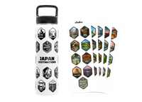
If you've already done the first-trip essentials and Hokkaido is calling, the Explorer Bottle II covers the destinations that don't show up on standard itineraries, built for repeat travelers and Japan residents.
What is Hokkaido, and where is it?
Hokkaido is the northernmost of Japan's four main islands and its single largest prefecture. Rakuten Travel puts it at about 22.1% of Japan's land area, roughly 39.7 times the size of Tokyo. It sits far enough north that its climate, farmland, and travel seasons work differently from the rest of the country.
That scale is the first thing to internalise when planning. On a map of Japan's 47 prefectures, Hokkaido is one prefecture that looks like a region, because functionally it is one. Sapporo, the main city, anchors the west. Furano and Biei sit in the farm belt at the island's center. Shiretoko and the great lakes are a full day's travel east. Cape Soya, the northern tip, stares across the strait at Sakhalin.
Rurubu notes that Hokkaido consistently ranks at or near the top of Japan's "prefecture people most want to visit" surveys. Domestic travelers treat it the way many of us treat New Zealand or Iceland: the landscape trip. That's the version of Hokkaido this guide is about.
The practical consequence: don't try to see it all in one pass. Pick one or two zones per trip, the center for farmland, the east for wilderness, and let the rest pull you back.
Why is Furano Japan's lavender country?
Furano's valley holds Japan's most famous lavender fields, blooming early July to early August against the Tokachi mountain range. Farm Tomita, the country's oldest sightseeing lavender farm, is free to enter and anchors a road of flower farms nicknamed the Hanabito Kaido.
Rakuten Travel's Furano guide opens with the image every Japanese traveler already carries: lavender fields "spread like a purple carpet" under Mt. Tokachi. The farms cluster along Route 237, which locals call the Hanabito Kaido, the flower-people road.
Farm Tomita in Nakafurano is the anchor. It's Japan's oldest sightseeing lavender farm, with 14 flower fields and around 80 flower varieties running spring to autumn. Entry is free. Its largest lavender field, Lavender East, sits about 4 km away and opens only for the July peak. In summer, a train station called Lavender-Batake opens just for the season, a 7-minute walk from the farm.
The valley rewards going one farm deeper than the crowds. Rakuten's listing includes a town-run field on a ski slope in Nakafurano, the only lavender farm in Japan with a chairlift (¥400 return), and Highland Furano's "Lavender Sea," 16,000 square meters of late-blooming lavender that peaks after the other farms fade, with an onsen bath overlooking the field. Kanno Farm sits right on Route 237 near Bibaushi Station, free, with hand-planted flower slopes and white corn sold at the stand in season.
📍 Location: Furano valley, central Hokkaido, along Route 237 💴 Price: Farm Tomita free; chairlift field ¥400 return ⏰ Best time: Early July to early August for the lavender peak; early morning at Farm Tomita 🚶 Access: JR Lavender-Batake Station (summer only), 7-min walk to Farm Tomita
Timing is everything here. The peak lands in July, which is also one of the best months to be in Japan's north while the rest of the country swelters. Our guide to Japan in July covers that trade in more detail.
Furano also feeds you well. The same Rakuten guide lists FB Furano Burger, a farm-direct shop using 100% Kamifurano pork (burger plate ¥1,500, open late April to late October), the Furano Cheese Factory with Japan's only wine cheddar and a ¥400 fresh-cheese soft serve, and Kumagera, a restaurant near Furano Station founded in 1980 whose game hotpot for two runs ¥3,600. In town, Furano Marche gathers the valley's produce and around 2,000 local food souvenirs seven minutes' walk from the station, and Furano Delice bakes the milk pudding in a glass bottle (¥401) that Japanese visitors order from across the country.
Kumagera appeared in the TV drama Kita no Kuni kara, which brings us to the valley's other identity. The series ran from 1981 to 2002 and its filming locations are pilgrimage stops for Japanese travelers of a certain generation: the preserved sets in the forest at Rokugo (¥500 entry), and the free Fukiage open-air bath the show made nationally famous. Even without the nostalgia, the forest village of Ningle Terrace, 15 log-cabin craft shops produced by the show's screenwriter So Kuramoto on the grounds of the New Furano Prince Hotel, is worth an evening; the lamps come on after dark and the whole hillside glows.
What makes Biei's hills so cinematic?
Biei, one town north of Furano, is nicknamed "the town of hills." Its rolling patchwork farmland, the Blue Pond, and lone trees named after old TV commercials make it the most photographed countryside in Japan. Rakuten's local staff advise early mornings and walkable shoes.
Biei's own branding, quoted in Rakuten Travel's Biei guide, is Oka no Machi Biei, the town of hills. The town covers 676 square kilometers, comparable to Tokyo's 23 wards combined, and most of it is wave-shaped farmland that changes color by crop and season.
The famous single spot is the Shirogane Blue Pond, standing dead larches in water that shifts between cobalt and emerald depending on season and hour. Rakuten's local staff give the two tips that matter: go early in the morning before the buses, and wear proper shoes because the path is unpaved. Ten minutes up the road, Shirahige Falls drops groundwater into the Biei River, a stretch locals call the Blue River, viewed from the bridge directly above.
Then there are the trees. The Ken & Mary Tree is a lone poplar named after a 1970s Nissan Skyline commercial. The Mild Seven Hill carries a single row of larches on its crest, named after a cigarette ad. This is a countryside so photogenic that individual trees have advertising careers. The staff comment on the Mild Seven Hill in Rakuten's guide is the honest summary: no two days show the same view.
For flowers without the Furano crowds, Shikisai no Oka plants about 30 varieties in stripes across 14 hectares, peaking July through September (¥500 entry in season, tractor bus ¥500). The staff tip here is small and telling: the croquettes at the farm shop taste like Hokkaido potatoes and nothing else. For the view over everything, Shinei no Oka gives a 360-degree panorama of the patchwork and is the sunset spot the staff single out.
Rakuten's staff also point to a local trio they call Biei's three power spots: the Blue Pond, Shirahige Falls, and Biei Shrine, where heart-shaped inome carvings hide across the buildings and finding one is said to help your luck in love. Take that as seriously as you like; the embroidered landscape amulets are a genuinely good souvenir. Up the valley, Shirogane Onsen has been known since long ago as the waters where you forget your cane, and above it the Tokachidake Bogakudai viewpoint at 930 meters faces the volcano's active vents directly, closed in winter, raw the rest of the year.
Families get their own version of the hills. Farms Chiyoda runs a free petting farm year-round, feed for the animals from ¥100, and the Biei dairy farms sell soft serve made from that morning's milk. Forty minutes' drive north, Asahiyama Zoo (adults ¥1,000, junior-high and under free) built its national fame on behavior exhibits: penguins overhead in a water tunnel, seals rising through a vertical column. Domestic families treat it as a full day.
Photographer's note. Biei is a morning place. The hills run in long ridgelines, so the first low light rakes across them and every furrow throws a shadow; by midday the patchwork flattens into a postcard. Stand at Shinei no Oka with the sun behind you and shoot along the ridges, not across them. In July, the potato flowers turn whole hillsides white for a few weeks, and the staff's line about tractors looking like minicars is the scale cue worth including in the frame.
Biei's town center also holds the countryside's best coffee. Kissa Suzuran has poured the same house blend since 1961 (¥500), the oldest kissaten in town, and Gosh near Bibaushi Station roasts over a direct flame and keeps its quiet room adults-only.
Where can you see Hokkaido's sea of clouds?
Hokkaido has multiple dawn sea-of-clouds (unkai) spots. The Unkai Terrace at Hoshino Resorts Tomamu is the famous one and admits day visitors. The Furano Ropeway sees cloud seas on August-to-October mornings, and Tsubetsu Pass in the east runs June to October.
Unkai, the sea of clouds, is the single most cinematic thing Hokkaido does, and Japanese media covers it as its own travel genre. Aumo's roundup of Hokkaido cloud-sea spots makes the ground rules clear: it happens at dawn, for a few hours at most, and you sleep nearby or you miss it.
The headline act is the Unkai Terrace at Hoshino Resorts Tomamu, a gondola-served mountainside terrace strung with viewing decks: a lighthouse deck, a Cloud Bar, a Cloud Pool, and the Cloud Walk, a walkway that floats you out over the cloud layer. Aumo notes it's open to day visitors, not just hotel guests, so an early alarm from Furano puts it in reach, and the resort below runs dawn hot-air balloon flights, canoeing, and horseback rides for the hours after the clouds burn off.
Closer to the lavender, the Furano Ropeway runs a 101-person gondola to about 900 meters, where Rakuten notes cloud seas appear on early mornings from August to October (¥2,800 return). In the east, Tsubetsu Pass sits at 947 meters between Lakes Kussharo and Mashu, with cloud seas from June to October and a castle-like observatory open through the warm months. And Lake Mashu itself, famous for water clarity, grows cloud seas over the caldera at dawn; aumo's practical advice is to stay in Teshikaga town or the old onsen street at Kawayu, because no train runs at that hour.
Cloud chasing is the clearest example of what rural Hokkaido asks of you: commit to the place overnight, get up in the dark, and let the landscape decide. When it works, you understand why Japanese travelers build whole trips around it.
What's in eastern Hokkaido's wilderness?
The east holds Hokkaido's wildest scenery: the Shiretoko World Heritage peninsula with orca and whale cruises, Japan's largest wetland at Kushiro with red-crowned cranes, and the caldera lakes Mashu and Akan. It's the least convenient part of the island and the most rewarding.
Shiretoko is the far northeastern peninsula, a national park whose land and sea are inscribed as World Heritage. Rakuten Travel's Hokkaido guide highlights the Shiretoko Five Lakes and the Kamuiwakka hot falls, but the detail that stops most readers is the cruise calendar out of Rausu: orca encounters peak in spring, sperm whales arrive in summer, and in winter the boats push through drift ice under Steller's sea eagles. One small port, three different documentaries depending on the month.
South of it, the Kushiro Wetland is Japan's largest, 28,788 hectares of it, home to the red-crowned crane, a special natural monument. Five observatories and six boardwalk trails edge the marsh, and in summer you can canoe the river through it. Lake Akan adds the caldera-lake version of the east: marimo moss balls, another natural monument, and Japan's largest trout, the itou, in its waters.
Lake Mashu deserves its own stop even outside cloud-sea hours. Aumo's guide credits it with world-class water clarity and maps the three viewpoints: the first observatory has the rest house and parking, the third is free and quieter, and the "back Mashu" observatory on the far rim, shared with neighboring Kiyosato town, is the one for travelers who want the lake to themselves (closed in winter). The nearby town of Teshikaga and the old hot-spring street at Kawayu Onsen make the natural base.
Give the east four days minimum if you come at all. The distances are honest here: this corner of Hokkaido sits closer to the Kuril Islands than to Sapporo, and treating it as a day trip is how travelers end up seeing it through a windscreen.
None of this is on the way to anything. That's the point, and it's why the east is where the Explorer-stage traveler ends up.
❤️ For travelers building a longer Japan itinerary, the Explorer Bottle illustrates 46 destinations across 31 prefectures — with stickers to mark off each one as you visit, designed for locals, residents, and repeat travelers. Live on Kickstarter now.
How far north can you go?
To the end of the country. Cape Soya at Wakkanai is Japan's northernmost point, with Sakhalin visible on clear days. Offshore, Rishiri Island rises as a single volcano from the sea, and Rebun, Japan's northernmost inhabited island, blooms with about 300 alpine flower species each summer.
Rakuten's Hokkaido guide describes Cape Soya with the kind of detail that tells you how domestic travelers treat it: shops near the monument sell a certificate of arrival at Japan's northernmost point, stamped with the date. It's a pilgrimage marker. On a clear day, the Russian island of Sakhalin sits on the horizon.
The ferries from Wakkanai reach the two islands that justify the journey. Rishiri is a near-circular island, about 63 km around, built entirely from the cone of Mt. Rishiri, one of Japan's 100 Famous Mountains; the view across Otatomari-numa pond to the peak is the scene printed on the Shiroi Koibito biscuit tin, the most famous souvenir packaging in Japan. The island's other exports set the menu: Rishiri kombu, the kelp grade top kaiseki kitchens name-check, and ezo-bafun uni landed in summer. Rakuten's guide lists uni-gathering experiences where you scoop your own from a boat.
Rebun, the northernmost inhabited island in the country, is nicknamed the floating island of flowers: around 300 species of alpine plants bloom at sea level in summer, because the latitude does what altitude does elsewhere. Seven trekking courses cross the island, and the reward structure is simple: walk, flowers, onsen, uni bowl, repeat.
This is as rural as Japan gets. It's also, in July, one of the most quietly spectacular places in the country, wildflowers, uni season, and 4 a.m. sunrises included.
When should you visit Hokkaido, summer or winter?
Summer (June to September) is for lavender, hills, cloud seas, and hiking, with July the single best month. Winter (December to March) is for powder snow, drift ice, and eagles. Japanese travel media treats them as two different destinations, and both are correct answers.
The honest comparison, built from the seasonal claims in the sources above:
| Hokkaido summer | Hokkaido winter | |
|---|---|---|
| The landscape | Lavender carpets, green patchwork hills, alpine flowers | Snowfields, drift ice off the northeast coast, frozen falls |
| Signature moment | Farm Tomita at peak bloom, early July to early August | Drift-ice cruising under sea eagles out of Rausu |
| Cloud seas | Yes, June to October depending on the spot | Rare; terraces and passes mostly closed |
| Access | Everything open; summer-only stations running | Many rural spots closed or restricted; roads demand care |
| Best for | First Hokkaido trip, photographers, road trips | Skiers, ice and wildlife chasers, repeat visitors |
If it's your first pass at the island, take summer; the countryside this guide describes is fully open, and the July lavender window overlaps with the best weather. Winter Hokkaido is a specialist's reward, and a real one: Rakuten's island-wide guide lists icebreaker cruises out of Monbetsu that crunch through the drift ice of the Okhotsk coast, the same ice the Rausu boats work for eagle photography. Book the winter trip after you've met the island once in the green.
Shoulder seasons are the quiet bargain. September and October keep the cloud-sea mornings and add autumn color to the passes, with the summer crowds gone. For how Hokkaido's calendar fits the national one, see our guide to the best time to see Japan.
Free for you: our Tokyo Google Maps list We keep a Google Maps list of the must-see spots around Tokyo - restaurants, cafes, shops, viewpoints, and streets worth the detour. Drop your email and we'll send it over.
How do you actually get around rural Hokkaido?
Fly into New Chitose (for Sapporo and the center) and treat the countryside as rental-car territory. Japanese listings give rural access as taxi rides from small stations, and key spots close or lose transport links off-season. Trains work between hub cities, not between hills.
Read enough Japanese listings for this region and a pattern emerges. Access lines for Biei's hills say "taxi, about 5 to 20 minutes from JR Biei." The Blue Pond is a 20-minute taxi from the station. Farm Tomita's dedicated train station operates only in summer. The Rokugo forest is a 30-minute walk past the end of a bus line. Rakuten's staff comments suggest renting a bicycle at the Shirogane roadside station to reach the Blue Pond and Shirahige Falls, which is the pleasant-weather version of the same message: the countryside assumes you brought your own wheels.
So build the trip that matches the island. Fly to New Chitose, take the train to a base (Furano and Biei town centers both work well and hold the cafes and marchés listed above), then rent a car for the days you go looking for hills, lakes, and dawn. Drivers should note the Jet Coaster Road in Kamifurano, 2.5 km of dead-straight rise-and-fall farm road that locals count among their eight great views, best enjoyed at legal speed with the Tokachi range filling the windscreen.
One more local secret from the sources: the Fukiage open-air onsen sits on the slope of Mt. Tokachi, free, open around the clock, mixed bathing with swimwear allowed, no changing hut. It's the kind of place a rental car earns you.
The cities earn a mention as bookends rather than destinations. Rurubu's Hokkaido roundup treats Sapporo and Otaru as a standard one-night pairing, Otaru for its 1,140-meter canal, completed in 1923 and still lined with stone warehouses, and Hakodate in the far south for its 334-meter ropeway night view and a morning market that has fed the port since 1945, where the seafood-bowl breakfasts start around five in the morning. If your flights route through either, give them an evening. Then head back out to the hills, because in Hokkaido the countryside is the main event, and the sources this guide is built on are unanimous about that.
FAQ
What is Hokkaido, Japan known for? Hokkaido is Japan's northernmost main island and its largest prefecture, about 22% of the country's land. It's known for landscape at a scale the rest of Japan can't offer: Furano's July lavender, Biei's patchwork hills, dawn seas of clouds, Shiretoko's World Heritage wilderness, and deep winter snow.
When is the best time to visit Hokkaido? Depends which Hokkaido you want. July is the lavender peak and the island's best all-round month. August to October brings cloud-sea mornings. Winter is for powder, drift ice, and eagles. Domestic travel media treats summer and winter as two separate destinations.
Do you need a car in rural Hokkaido? For the countryside, effectively yes. Japanese listings routinely give access as a taxi ride from the nearest small station, and one lavender-field station only operates in summer. Trains connect the hub cities; the hills between them are car territory.
Is Furano worth visiting outside lavender season? Yes, with adjusted expectations. Flowers run to early October at Shikisai no Oka, the ropeway sees autumn cloud seas, and winter turns the valley into a ski area. What disappears outside summer is the purple, not the scenery.
If rural Hokkaido is the Japan you're working toward, the Explorer Bottle II features the destinations we go back to — places that take longer to reach but reward the trip. Live on Kickstarter now.
Sources
- Rakuten Travel — 北海道・富良野観光の魅力23選
- Rakuten Travel — 美瑛のおすすめ観光スポットBEST20
- aumo — 北海道で雲海が見たい!おすすめスポット6選
- Rakuten Travel — 北海道の観光名所72選
- Rurubu & more — 北海道のおすすめ観光スポット40選
Activities and tours in Tokyo
cheku is a GetYourGuide partner. We link to tours that handle the parts of travel that eat your time, getting there, booking ahead, language, context you'd otherwise miss. If you book through our link, we earn a small commission at no extra cost to you.


